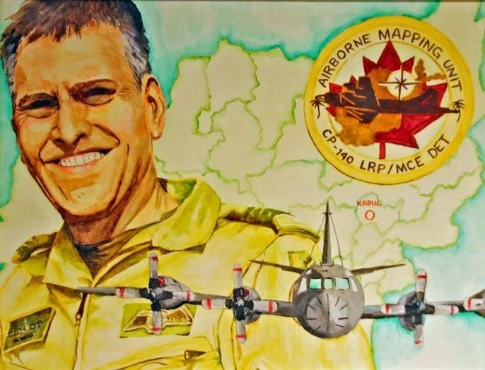
AIRBORNE MAPPING UNIT
In late February 2009, 14 Wing Greenwood was directed to provide a Long Range Patrol Detachment to deploy for aerial mapping missions over Afghanistan. Led by Lieutenant-Colonel James A. Irvine, the “Air Mapping Unit” was comprised of air and ground crews from both Greenwood and Comox, as well as geographic survey specialists from the Mapping and Charting Establishment in Ottawa. The unit deployed to the theatre of operations on 28 April 2009.
Crews were tasked to map all of Kandahar Province in Afghanistan, the primary area where the Canadian Armed Forces (CAF) were operating at that time, and other areas of interest to Australian, American, British and Dutch allies, but only upon completion of the Canadian mapping requirements. To accomplish the mapping and imagery mission, a specialized “Applanix” camera system was installed in the same aircraft camera bay that held the legacy KA107 reconnaissance camera.
Due to their great professionalism the air, ground and mapping crews were able to overcome many operational, environmental and logistical challenges and completed all the tasked mapping areas and some extra in support of allied operations.
Area of Afghanistan mapped – 114,000+ square kilometers
Hours flown (operational on station) – 129.7
Hours flown (total including all transits) – 260.2
Missions lost due to maintenance – Zero
Missions impacted by maintenance – 1 (2.5 mission hours lost due to delayed departure)
Missions lost due to weather and sandstorms – 4.5 missions